sábado, 5 de febrero de 2011
Castillo de Manzanares el Real - (Serie) Castle of Manzanares el Real
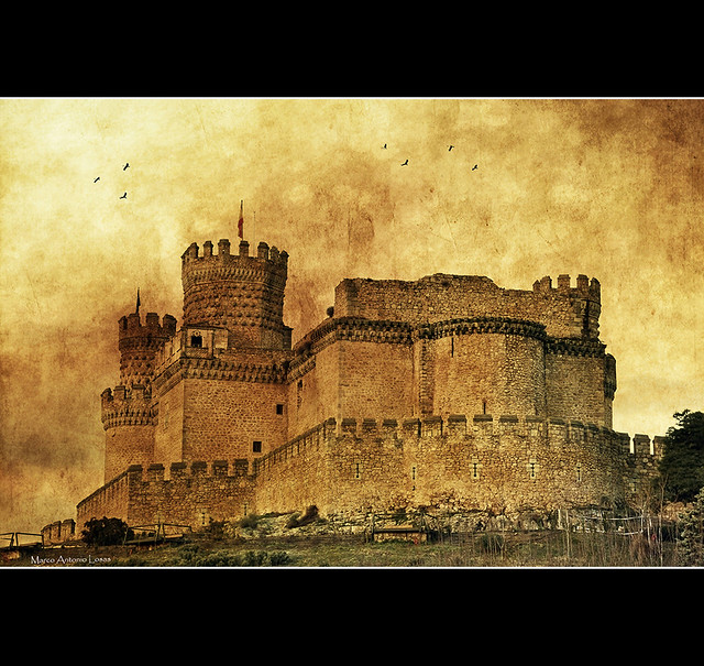
Una visión diferente sobre este famoso y fotografiado castillo.
A different vision on this famous and photographed castle
A different vision on this famous and photographed castle
All Rights Reserved. Please don't use my images on websites, blogs or other media without my explicit permission.
© All rights reserved - Marco Antonio Losas.
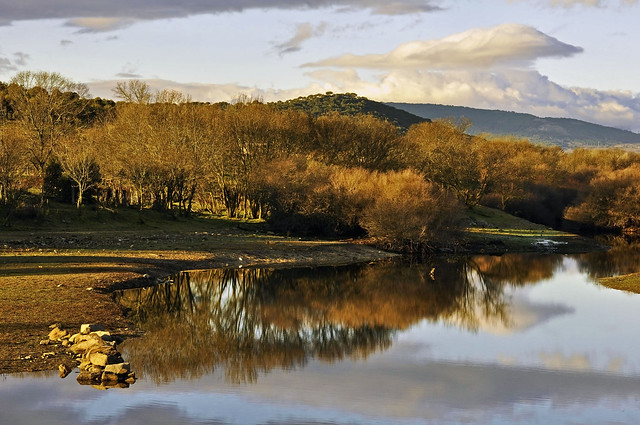
Despidiendo el alba - Saying goodbye at dawn
All Rights Reserved. Please don't use my images on websites, blogs or other media without my explicit permission.
© All rights reserved - Marco Antonio Losas.
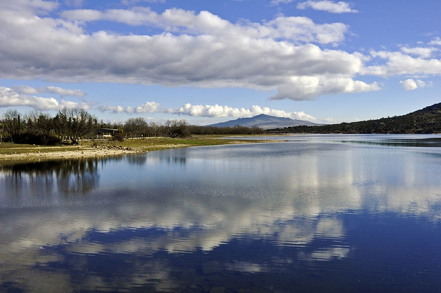
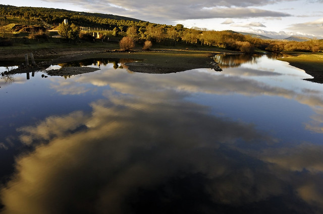
Espejo de nubes - Clouds Mirror
All Rights Reserved. Please don't use my images on websites, blogs or other media without my explicit permission.
© All rights reserved
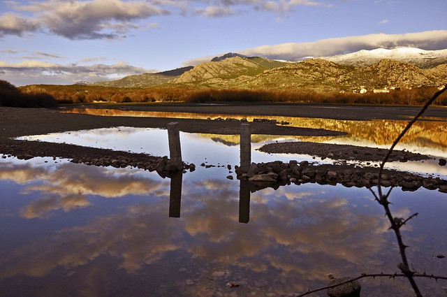
Reflejos de piedra - Reflections of stone
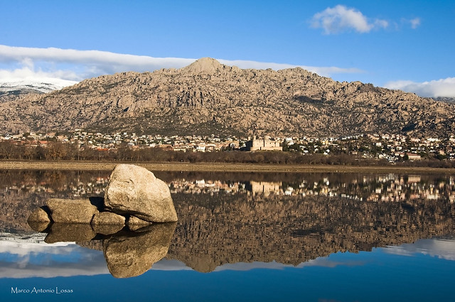
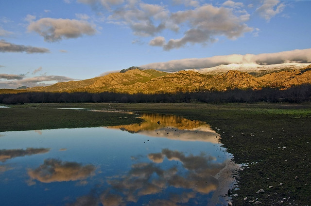
El Yelmo (1.717 metros), pico más alto de La Pedriza.
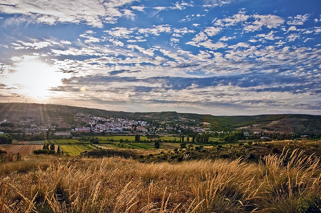
Manzanares el Real con su castillo fortaleza del siglo XV, y en primer plano el embalse de Santillana.
The Helmet (1.717 meters), peak more high of The Pedriza.
Manzanares el Real con su castillo fortaleza del siglo XV, y en primer plano el embalse de Santillana.
The Helmet (1.717 meters), peak more high of The Pedriza.
Manzanares el Real with his castle strength of the 15th century, and in the first plane Santillana's reservoir.
All Rights Reserved. Please don't use my images on websites, blogs or other media without my explicit permission.
© All rights reserved
Colores de invierno - Winter colors
All Rights Reserved. Please don't use my images on websites, blogs or other media without my explicit permission.
© All rights reserved
Reflejos al amanecer - Dawn reflections
All Rights Reserved. Please don't use my images on websites, blogs or other media without my explicit permission.
© All rights reserved
Pilares de la Tierra - Pillars of the Earth
Dedicada a mis hijos, David y Adrian. Luz y soporte cada día.
Dedicated to my sons, David and Adrian. Light and support every day.
Dedicated to my sons, David and Adrian. Light and support every day.
All Rights Reserved. Please don't use my images on websites, blogs or other media without my explicit permission.
© All rights reserved
Amanecer - Dawn
Vista desde el pantano de Santillana (Manzanares el Real). En lo alto empezando por la izquierda se encuentra el puerto de Navacerrada y la Bola del Mundo (antenas de comunicaciones) con una altura de 1858 metros y hacia la derecha con un manto de nubes sobre ellos podemos observar los picos de Cabeza de Hierro (2838 mts), punto más alto de la conocida Cuerda Larga. La Cuerda Larga es uno de los principales ramales montañosos de la Sierra de Guadarrama (sierra perteneciente al Sistema Central). Esta línea montañosa se extiende de oeste-suroeste a este-noreste dentro del noroeste de la Comunidad de Madrid (España) y tiene una longitud de 16 km en línea recta. Comienza en el Puerto de Navacerrada (extremo oeste) a una altitud de 1.858 metros y termina en el puerto de la Morcuera 1796 metros (extremo este).
La travesía de la Cuerda Larga es una clásica Madrileña. Este año me toca recorrerla, pero en primavera, con climatología menos adversa.
Por debajo de estos picos nevados y los primeros montes que observamos en la foto hacia la derecha se encuentra el paraje de La Pedriza, una joya de piedra granítica que hace las delicias de escaladores y excursionistas.
View from the dam of Santillana (Manzanares el Real). On the top starting with the left is the port Navacerrada and Bola del Mundo (satellite communications) with a height of 1858 meters to the right with a blanket of clouds on them we can observe that Cabeza de Hierro (2838 m), highest point of the famous Long Rope. Long Rope is one of the main branches of the mountainous Sierra de Guadarrama (mountain belonging to the Central System). The mountain line extending west-southwest to east-northeast in the northwest of the Community of Madrid (Spain) and has a length of 16 km in a straight line. Start the Puerto de Navacerrada (west end) at an altitude of 1,858 meters and ends at the port Morcuera 1796 meters (far east).
The crossing of the rope is a classic Long Madrid. This year I have to go, but in spring, with less adverse weather.
Below these peaks and the first mountains we see in the picture to the right is the site of La Pedriza, a jewel of granite that is the delight of climbers and hikers.
All Rights Reserved. Please don't use my images on websites, blogs or other media without my explicit permission.
© All rights reserved
Carabaña (Madrid)
Atardecer en el pueblo de Carabaña. El pueblo (1.600 habitantes) está ubicado en la falda de una pequeña montaña y asomado a la Vega del Tajuña, donde los campos de cultivo comparten su espacio con la Vía Verde del Tajuña, una vía de más de 60 kms, que se inicia en Arganda del Rey, donde podemos llegar en metro, y termina en el pueblo de Ambite. Ciclistas, patinadores, caminantes, etc., se dan cita cada día y sobre todo los fines de semana.
Sunset in the village of Carabaña. The town (1,600 inhabitants) is located at the foot of a small mountain overlooking the Vega of Tajuña, where the fields share their space with Tajuña Greenway, a route over 60 km, starting in Arganda del Rey, where we can reach by subway, and ends in the village of Ambite. Bicyclists, skaters, walkers, etc., Meet every day and especially on weekends.
All Rights Reserved. Please don't use my images on websites, blogs or other media without my explicit permission.
© All rights reserved
Aldeanueva de la Vera
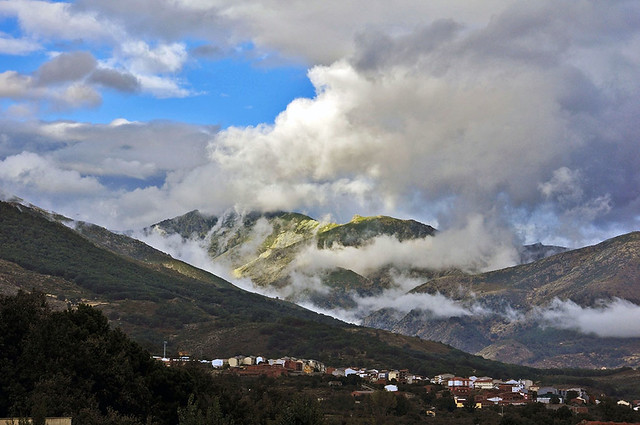
Aldeanueva de la Vera es un municipio español, en la provincia de Cáceres, Comunidad Autónoma de Extremadura. Pertenece a la Comarca de la Vera, de la cual, con más de 2000 habitantes, es el cuarto municipio más poblado.
Se sitúa a la falda de la sierra; entre la de Tormantos y Jaranda o Peña Negra, y en una ladera a 300 pasos de la garganta Horcajo. El término municipal linda, entre otros municipios, con Garganta la Olla, Cuacos de Yuste, El Guijo de Santa Bárbara y Jarandilla de la Vera. Fundada en la Edad Media como aldea de Plasencia, en 1802 se le concedió el título de villa.
Aldeanueva de la Vera is a Spanish municipality in the province of Cáceres, Autonomous Community of Extremadura. Belongs to the region of la Vera, which, with more than 2000 inhabitants, is the fourth most populous municipality. It is situated at the foot of the mountain, between that and Jaranda Tormantos or Black Rock, and on a hillside just 300 steps from the throat Horcajo. The township borders, among other municipalities, Garganta la Olla, Cuacos de Yuste, The Santa Barbara Guijo Jarandilla de la Vera. Founded in the Middle Ages as a village of Plasencia in 1802 was awarded the title of town.
Fuente: Wikipedia.
All Rights Reserved. Please don't use my images on websites, blogs or other media without my explicit permission.
© All rights reserved
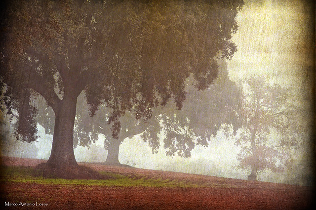
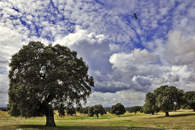
Encinares Toledanos
All Rights Reserved. Please don't use my images on websites, blogs or other media without my explicit permission.
© All rights reserved
Garganta de Cuartos
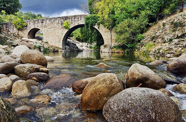
Puente Cuartos
Se encuentra sobre la garganta del mismo nombre y a dos kilómetros del núcleo urbano por la carretera EX-203. Es uno de los ejemplares típicos de la Vera, perteneciente al siglo XV, trazado en dos ojos en arco y cantería de granito. Cabe destacar que en este emplazamiento de la garganta Cuartos es una zona de baño muy discurrida por los turistas.
Se encuentra sobre la garganta del mismo nombre y a dos kilómetros del núcleo urbano por la carretera EX-203. Es uno de los ejemplares típicos de la Vera, perteneciente al siglo XV, trazado en dos ojos en arco y cantería de granito. Cabe destacar que en este emplazamiento de la garganta Cuartos es una zona de baño muy discurrida por los turistas.
Quarter Bridge is located on the throat of the same name and two kilometers from town along the road EX-203. One of the typical examples of the Vera, belonging to the fifteenth century, drawn by two arched eyes and granite quarrying. It should be noted that this location of the throat Rooms is a very popular bathing area runs through the tourists.
All Rights Reserved. Please don't use my images on websites, blogs or other media without my explicit permission.
© All rights reserved
Suscribirse a:
Comentarios (Atom)